
Walk St. Tammany Streets Carefully
A reliable street directory walk begins with the address, not a person. In St. Tammany Parish, the 9-1-1 address, GIS point, Assessor situs field, deed description, voter residence, and postal label can all describe the same place in different ways. Ownership is public through assessment and land records. Occupancy is harder. A voter record or dated printed directory may associate a person with an address, but neither source names every person there. Keep each source label intact.
- Standardize the address with USPS, while saving the spelling originally supplied. For a new or unclear structure, ask St. Tammany Parish Communications District 1 to verify the physical address.
- Locate the point in the parish GeoPortal. Turn on parcels, address points, streets, subdivisions, tax districts, and the most useful aerial layer.
- Copy the assessment number, legal lot or subdivision, and map date. Use the number in the Assessor search before trying street-name variants.
- Follow the present owner or entity into Clerk Land Records. Save the instrument number, filing date, party roles, and book or page reference.
- Use the Secretary of State address search only for the registered-voter layer. For an older street view, consult the matching library directory volume and state clearly what year it represents.
This five-source sequence is the core of a St. Tammany Parish street directory search. It moves from place to parcel to a dated public link. It does not turn one roll into proof of a whole household.
Search St. Tammany Addresses Precisely
The St. Tammany Parish Assessor search is strongest when the GIS has already supplied an assessment number. The Assessor FAQ also documents owner name, address, mailing address, care of, and property description as search angles. Street suffixes often block a match, so omit words such as Street, Drive, or Road and try official variants. Select the assessment year before comparing two results because the current and certified rolls may describe different snapshots.
| Portal field | How to use it | Street-search caution |
|---|---|---|
| Assessment Year | Choose the roll year before searching | The 2026 roll is current but unofficial during exposure |
| Search Type | Select assessment number or another supported angle | The live menu can change, so follow the current screen |
| Assessment Number | Enter digits without punctuation | Best bridge from GIS to the tax roll |
| Search and Clear | Run or reset the criteria | Save the exact query and result year |
| GIS by physical location | Return to the map when text fails | A map point still needs record confirmation |
A result may show a person, trust, company, succession, or other entity. It can include separate physical and mailing fields plus a legal property description. Those distinctions matter more than a familiar surname.
Map St. Tammany Street Parcels
The St. Tammany GeoPortal turns a street label into parcel polygons and record keys. Its tools include Search, Identify, Buffer, Measure, Print, Search History, and CSV export where enabled. Layers cover address points, streets, parcels, subdivisions, tax districts, section-township-range, municipalities, and several aerial years. Use Identify on each lot instead of reading names from the shape alone.
The official GIS street and parcel layer list shows what the viewer can place together.
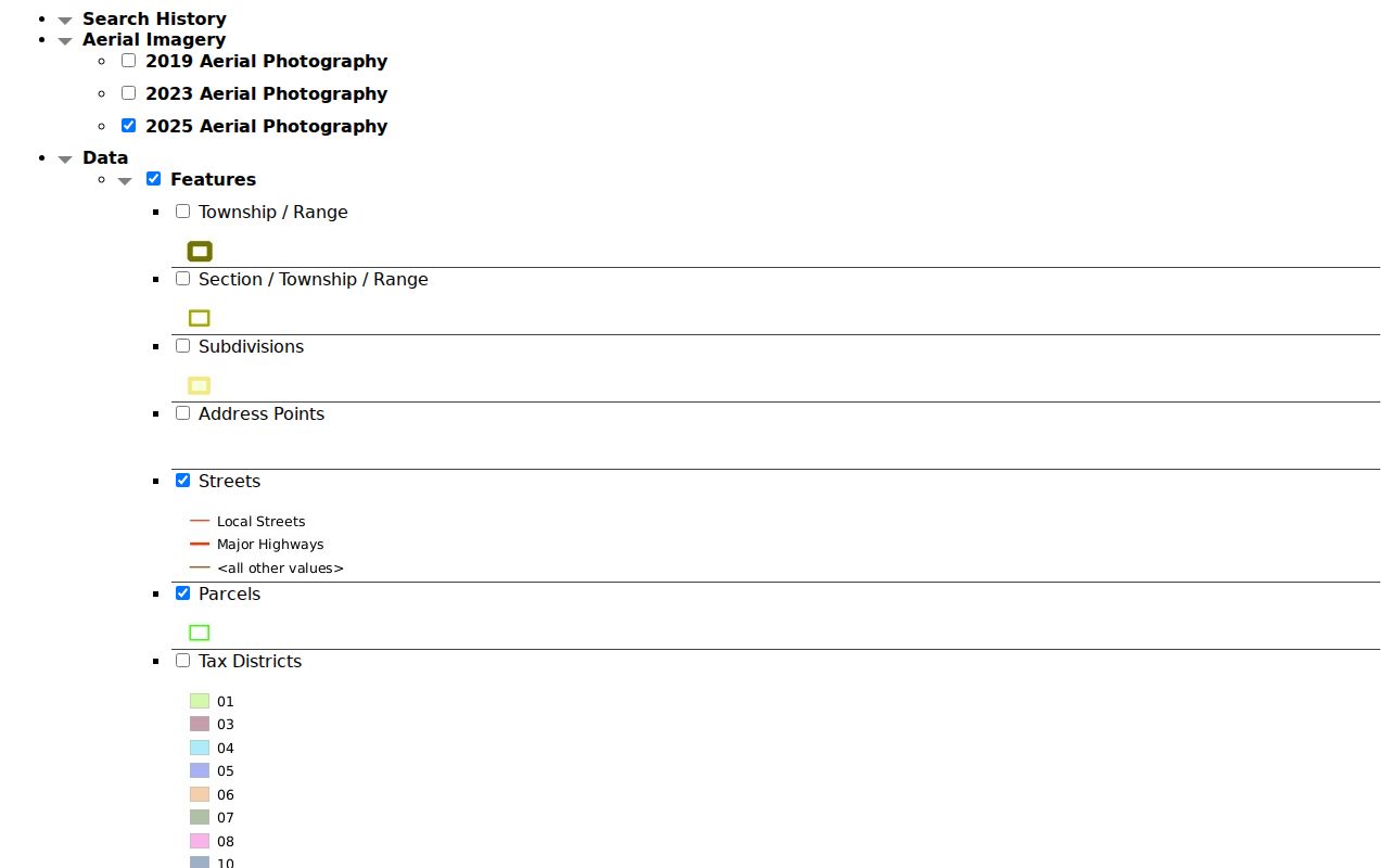
The layer screen is useful evidence of available map context, but the parish warns that layers can differ in scale and accuracy. Record the map date and verify a boundary with a recorded plat when it matters.
Note: A parcel touching another parcel is a map relationship, not evidence that the owners share a household or social connection.
Define St. Tammany Address Terms
Four terms prevent most mistakes in a by-address search. They distinguish land, location, recorded maps, and old printed listings.
- Parcel
- A mapped tract tied to an assessment number and legal description.
- Situs address
- The physical location assigned to the property, which may differ from the owner's mailing address.
- Plat
- A recorded survey map that shows lots, streets, rights-of-way, and servitudes.
- Criss-cross directory
- A printed directory arranged by street or address instead of only by surname.
The Assessor change-of-address form itself separates property location or legal description from old and new mailing addresses. A street directory should preserve both and never quietly relabel the mailing destination as a residence.
St. Tammany Street Record Layers
No single official roll lists every person along a road. A St. Tammany Parish street directory is built from sources that answer different questions. The keeper, address key, and access route should travel with each result.
| Record Set | Keeper | What It Shows | Access |
|---|---|---|---|
| Assessment roll | Parish Assessor | Owner or entity, situs, mailing, care of, legal description | Free portal and office confirmation |
| GIS parcel map | Parish GIS | Address points, parcels, streets, subdivisions, tax districts | Free viewer |
| Land records | Clerk of Court | Deeds, liens, maps, party roles, instruments | Cott or legacy subscription, counter, email, phone, copy form, Archives |
| Voter records | Secretary of State and Registrar | Registration and district fields allowed for release | Address portal, list request, or Registrar |
| Planning and permits | Parish or municipality | Lot, plat, permit, applicant, inspection, occupancy event | Department search or public-record request |
| Printed directories | St. Tammany Parish Library | Dated occupant, phone, business, and address entries | Library-use-only catalog holdings |
The parcel number links the map to the assessment. The legal description and instrument link the lot to the Clerk. Street spelling links those records to voter, permit, and printed sources, but the date and field label show what each match can truly support.
Trace St. Tammany Deeds by Street
The Clerk Land Records Department keeps acts of sale, mortgages, judgments of possession, cancellations, liens, maps, surveys, and related filings. Cott Record Hub went live on July 27, 2026, while the legacy system remains in transition through the end of 2026. A current search may therefore require the new hub, the older subscription portal, or help from the ground-floor counter.
For 1918 forward, the current copy form accepts an instrument number, party and role, document type, filing date, and certification choice. Earlier land requests go to Archives and use vendor and vendee names plus book, page, and recording date. Vendor and vendee are older Louisiana terms for seller and buyer. Walk a street deed by deed only when each parcel is locked to its legal description. Similar civic numbers can sit on different lots.
Online channels do not replace the counter. Land Records can be reached by phone or email, and Archives covers older material. Certified copies cost more than plain pages, while a portal view is still just an index until the filing image is checked.
Verify New St. Tammany Streets
St. Tammany Parish Communications District 1 assigns municipal addresses for emergency response. Its online address request accepts a deed legal description, survey, coordinates, or aerial plot. Adjacent physical addresses can speed the work, an unusually useful local clue when a new lot has no stable number. Current demand can put the stated turnaround at seven to ten business days.
The parish also requires visible address digits at least four inches high. New construction, expansion, or renovation cannot receive a building permit until an address is assigned, and final inspection depends on posted numbers. That makes the verified-address letter, permit file, GIS point, and deed description a strong four-way check.
Note: Keep the old spelling beside the standardized address because historic books and recorded instruments may index the same road differently.
Read St. Tammany Permit Streets
Planning files can explain why a street gained new lots or why an address moved. Parish subdivision checklists name the developer, surveyor, section-township-range, lot count, streets, utilities, covenants, drainage servitudes, approvals, and recordation fields. Agendas may add a case number, owner, location, ward, and district. These are project records, not a list of occupants.
When no public index answers the question, use the St. Tammany Parish public-record request form. Select Development-Permits, Development-Planning, Inspections and Enforcement, Engineering, Utilities, or the best matching department. Give the street, subdivision, lot, assessment number, permit or case range, dates, and desired electronic or inspection format. Narrow requests are easier to route and reproduce.
Check St. Tammany Voters by Address
The Louisiana voter address search can show the voter and district layer for one address. Released list fields may include name, residence or mailing address, ZIP, status, registration date, precinct, ward, and districts. Social Security numbers, driver-license numbers, email, complete birth details, and Address Confidentiality Program information are withheld.
A voter match means registration, not a complete household count. Some eligible people are not registered, some records lag a move, and protected records will not appear. Current precinct questions should go to the St. Tammany Registrar of Voters, especially after the January 2026 changes affecting several precincts and the 909A split.
Browse Old St. Tammany Streets
Printed Polk holdings at St. Tammany Parish Library include separate Covington, Covington and Mandeville, Slidell, parish-wide, and regional suburban runs. Their street arrangement varies by volume, and research found no complete official reverse-directory run for every place and year. Ask staff whether the exact volume has a criss-cross section before relying on it.
An entry is a dated snapshot affected by publication lag. Pair it with a census, historical voter record, obituary, deed, or permit. The historical St. Tammany Parish directory collections deserve their own shelf-based search when the street question becomes a long household history.
Untangle St. Tammany Street Labels
Postal places, municipal limits, parish wards, ZIPs, and legal subdivisions are different shapes. A road near Slidell can carry a Lacombe, Pearl River, or West Slidell postal clue. Covington searches may surface Saint Benedict or Madisonville, while Sun and Talisheek sit among other nearby postal points. Those USPS nearby-place lists help test spellings, but do not draw a ZIP boundary.
Louisiana's official parish profile separates cities, towns, villages, census-designated places, and unincorporated communities. Keep each label as its source gives it. The legal description and parcel remain more stable than the mailing city for a street directory record chain.
Mandeville Streets Meet Private Rules
Mandeville's 2045 plan reports more than 50 subdivisions and 24 homeowners associations within city limits. It also draws a firm line: association agreements are private, and the city does not enforce or maintain them. A covenant can transfer with an act of sale, so the Clerk deed or plat is the sound place to seek restrictions, shared roads, and servitudes.
This local detail changes a by-street search. The public map may show the road and lot, while a recorded covenant explains maintenance or access. An association page adds community context but should never be treated as an official resident roll.
Limits of St. Tammany Street Records
A street directory cannot establish everyone inside a home. The Assessor identifies an owner of record, not an occupant. A deed proves a filed property event. A voter source covers registered voters under its own date and privacy rules. Permit applicants, tax-mail recipients, company agents, and association contacts may all live elsewhere. Protected voter and Address Confidentiality Program fields remain shielded.
Commercial neighbor-search products may merge stale and unrelated data. Official sources are slower but show a custodian, date, field name, and correction path. Keep a small research log with the query, roll or map date, assessment or instrument number, source URL, what was actually shown, and the next check. Correct errors with the custodian that created the record.
Lawful use. Use St. Tammany Parish address records for lawful personal research, family history, property questions, and civic awareness. Never use an address to stalk, harass, threaten, or harm anyone.
Resolve a mismatch at the source. Ask the Assessor about assessment fields, the Clerk about a recorded filing, the Registrar about voter data, and the addressing district about a civic number. Keep the old value, correction date, and office response in the street log so later searches can explain why two official screens once differed.