
Sources for St. Tammany Neighbors
A block lookup should answer one question at a time. The St. Tammany GeoPortal establishes spatial relationships. The Assessor labels owners, mailing fields, and assessment numbers. Clerk plats and deeds resolve recorded lines and shared rights. Voter and permit sources add dated civic facts. Community groups explain local contacts or common areas, but they are not public household rolls.
| Source | What It Shows About a Block | Access |
|---|---|---|
| St. Tammany GeoPortal | Touching parcels, address points, streets, subdivisions, and districts | Free viewer with Identify and Buffer tools |
| Parish assessment roll | Owner or entity, situs, mailing, care of, and legal description | Free search and Assessor office confirmation |
| Clerk plats and deeds | Recorded lot lines, servitudes, access, covenants, and title parties | Cott or legacy portal, counter, copy form, Archives |
| Voter and district records | Registration and district facts allowed for release | SOS address search, list request, or Registrar |
| Planning and permit files | Lot changes, applicants, inspections, utilities, and occupancy events | Agency search or narrow public-record request |
| Associations and watch groups | Shared amenities, private roads, community history, and contact leads | Recorded covenant plus current group confirmation |
These layers complement rather than replace each other. Owner of record is not the same as occupant. A mailing address can point off the block. An association name may be old. Save the date, label, and source with every nearby-parcel result.
Map St. Tammany Block Records
Open the St. Tammany GeoPortal and find the anchor address. Turn on address points, parcels, streets, subdivisions, tax districts, and a dated aerial. Use Identify on the anchor polygon, then on parcels touching its sides and corners. Record assessment number, legal lot, subdivision, frontage, district, and map date. Include common areas or tracts with no street number.
- Confirm the address point sits on the expected parcel.
- List the cardinal and diagonal parcel numbers around it.
- Open each parcel in the Assessor search and preserve its exact owner and address labels.
- Use the Clerk plat when a road, drainage strip, or common area interrupts visual adjacency.
- Log what the map proves and what remains unknown.
The Buffer tool can gather map results near a point, and CSV export may be available for a configured result. A buffer is a convenient search shape, not a legal boundary. For a full named-road chain, use the St. Tammany Parish street directory.
Compare St. Tammany Neighbor Owners
Search each assessment number separately in the Assessor portal. Capture the roll year, owner or entity, situs address, mailing address, care-of line, and legal description. A company, trust, succession, drainage tract, or association common area should remain labeled that way. Do not force every parcel into a person's name.
The current roll and certified roll are dated snapshots. The 2026 data was unofficial during the public-inspection cycle, while property descriptions for splits, combines, and resubdivisions could reflect an earlier cutoff. If the owner label controls a serious property question, confirm it against the latest Clerk instrument and the current Assessor office record.
Note: A matching owner and mailing address can support an ownership link, but it still does not list every person at the property.
Read St. Tammany Neighbor Plats
A screen map can make two lots look like direct neighbors even when a servitude, road reserve, drainage tract, or common area lies between them. The recorded plat is the stronger source for legal relationships. It may show lot lines, rights-of-way, access easements, drainage, streets, common ground, or subdivision restrictions.
- Copy the subdivision, lot, and assessment numbers from GIS and the Assessor.
- Search the Clerk's map and land records for the plat or linked instrument.
- Note book, page, instrument, map file, and every named servitude or dedication.
- Ask parish Planning or Engineering about public maintenance when the recorded status is unclear.
The Clerk Land Records Department offers the online index transition, public counter, phone, email, current copy form, and Archives route for older records. Those access paths matter when a map image is not online.
Layer St. Tammany Block Records
Zoning and tax-district layers add context without naming neighbors. The official parish zoning layer reflects ordinance changes effective August 2, 2024 and was last updated April 22, 2025. It supports queries, but its class describes allowed land use, not the people on a lot. Municipal limits, emergency service areas, wards, and tax districts can also split a visually continuous block.
Use the zoning layer date in a research log. If a recent resubdivision, de-annexation, or use change seems likely, search a Planning agenda or request the case and permit file by lot, subdivision, assessment number, and date range.
Place St. Tammany Neighbors in Precincts
The Louisiana SOS address search can answer which registered voters or districts are linked to an address under public-field rules. Released list data may include residence and mailing address, ZIP, registration status and date, precinct, ward, and districts. Protected fields and Address Confidentiality Program data are excluded.
Do not publish a block roster. Registration does not represent every occupant, and a protected voter may be absent. The St. Tammany Registrar is the current source for precinct and polling questions, including changes announced in January 2026.
Contact St. Tammany Neighbor Groups
Associations help explain common roads, drainage, amenities, and neighborhood projects. Their pages do not establish title or current residence. Confirm a covenant in Clerk records and confirm any contact with the group itself.
| Community lead | What research supports | Best confirmation |
|---|---|---|
| Mandeville subdivisions and HOAs | The city plan reports more than 50 subdivisions and 24 HOAs within city limits | Mandeville planning source and recorded covenant |
| Eden Isles HOA | Association says it formed in 1974 and works with the parish | Current association contact and Clerk plat |
| Neighborhood Watch leads | Names include Eden Isles, Dellwood/Lakeshore, Brookter-Trafalger, Huntwyck Village, Royal Gardens, and Circle O | Sheriff or current program contact |
| Parish community resources | Civic group names and public contact channels | Current organization page or phone |
The captured Neighborhood Watch directory results are useful as leads.
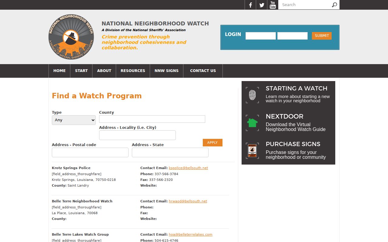
The listing should be checked before contact because a watch name or coordinator may change. It is not a list of all residents on the block.
Mandeville Neighbors Share Private Systems
Mandeville's 2045 plan provides a useful local distinction. The city counts more than 50 subdivisions and 24 HOAs within city limits, yet HOA agreements are private and the city does not enforce or maintain them. A private street may look public on the base map. The deed, plat, covenant, and planning file reveal who accepted maintenance and what was dedicated.
Eden Isles offers an East Parish contrast. Its association traces its start to 1974 and describes work with St. Tammany Parish. That history can guide a community question, while the recorded land instrument remains the authoritative route for servitudes, restrictions, and common property.
Prove a St. Tammany Neighbor Address
A new, rural, or split parcel may not have a stable civic number. St. Tammany Parish Communications District 1 accepts a deed legal description, survey, coordinates, or aerial plot for an address request. It specifically says adjacent physical addresses can speed the assignment. Current demand can make the process take seven to ten business days.
The strongest address proof combines three items: the legal description or survey, the 9-1-1 verified-address letter, and the GIS address point on the correct parcel. That triangle is more reliable than copying the nearest postal label from a map.
Compare St. Tammany Neighbor Sources
Official rolls and commercial neighbor tools serve different roles. A clean comparison helps avoid broad claims from merged data.
| Feature | Official parish or state source | Commercial category |
|---|---|---|
| Custodian | Named Assessor, Clerk, GIS, Registrar, or agency | Often compiled from many sources |
| Record date | Roll, filing, map, or registration date can be saved | Update date may be unclear |
| What it proves | A specific field under that record system | A merged association that needs verification |
| Correction path | Ask the office responsible for the source record | Use the provider's correction or opt-out process |
For property or civic questions, start with official data. Use a second independent source before describing someone as a current neighbor.
Protect St. Tammany Neighbors' Privacy
Public-record privacy is specific to each record. The Assessor may publish ownership fields while voter law withholds identity details and protected addresses. Louisiana's Address Confidentiality Program gives eligible survivors a substitute address for public agencies. Sealed court files, juvenile records, vital records, and other protected material also stay outside a routine neighbor lookup.
The Louisiana Address Confidentiality Program page explains the official protection.
The program is a reason to treat absence as unknown, never as proof that a person is not connected to a place. Do not seek ways around a protected address.
Lawful use. Research St. Tammany Parish neighbors only for lawful personal, family, property, safety, or civic purposes. Never use location data to watch, harass, threaten, or harm a person.
A good block log ends with four columns: what the map shows, what the Assessor or Clerk identifies, what a permit or voter source establishes, and what remains unknown. That final column prevents guesswork from becoming a claim.
When a source is wrong, send the correction to its custodian. The Assessor handles assessment fields, the Clerk handles recorded instruments, the Registrar handles voter data, and a private association handles its own contact page. One correction does not flow automatically into every other system. Recheck the block after the office posts its change, and retain the older date only as part of the research history.